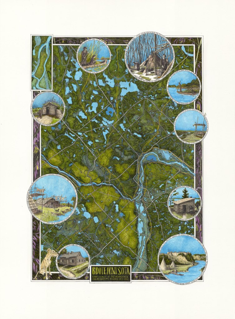
The drawing Bdote Mni Sota – Confluence of the Minnesota and Mississippi Rivers matches trails that existed in the early 1800s (yellow/orange lines) to the current day grid of highways (white lines). Early maps from residents of Fort Snelling of the 1830s, U.S. Land Survey maps of the 1840-50s, and topographical maps of 1890s were referenced to portray the Twin Cities before Dakota and Ojibwe land cessation and the urbanization and industrialization of the metro area. Lakes and streams in the darker cerulean blue were lost as they were filled in for development or channeled into sewers. The Mississippi was home to shifting sandbar islands, destroyed as the river was dredged to be navigable for commercial shipping, and the only natural major waterfall, Owamniyomni nka St Anthony Falls, was dammed to support the milling industry. In the center of it all is Bdote, the confluence of the Minnesota and Mississippi rivers, sacred to native people. Bdote Memory Maps describes Bdote as “where everything began and (where everything) began changing.”
Reference material that inspired and provided imagery and text include Jane Gibbs: the Little Bird that was Caught by Ann E Neuberger, Samuel Pond’s Dakota Life in the Upper Midwest, Seth Eastman’s paintings that depicted Dakota and Ojibwe ways of life, and the dioramas of the Mille Lacs Indian Museum. I wish I had found more original Dakota or Ojibwe reference material. It is my hope that creating this map of the Twin Cities that illustrates a land flourishing with native people serves to recognize that their lost ways of life.
The map border depicts the wild rice flower, a tiny purple gem that flourishes at mid-summer. While the flower only lasts a short time, as long as some of the rice falls back into the water at harvest, the life cycle of the wild rice plant will begin again.
See related posts:
