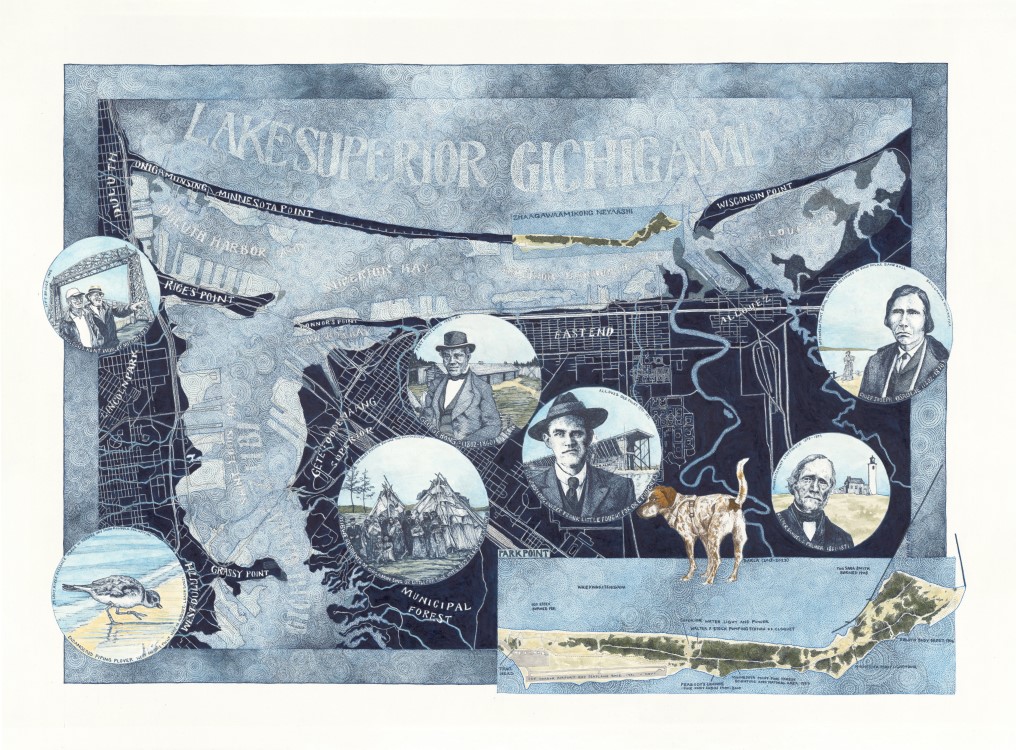
Park Point – 20 x 30 – Ink on Paper – 2023
Before the industrialization of the Duluth and Superior harbors, the waterways from the Saint Louis River into Lake Superior were shallow and marshy. The dark blue map is a compilation of early maps and drawings to portray the harbors before the canal was dug and the harbors dredged. The opening of the canal at Sault St. Marie in 1855 and the establishment of railroads turned the harbors into the concrete and steel we are familiar with today. From the single track trails of Park Point, you can catch glimpses of this past: ruins of the first lighthouse and decaying ore docks among old growth white pine.
See additional information in my posts about the Old Standby, Chief Osaugie, Frank Little, and George Bonga.
