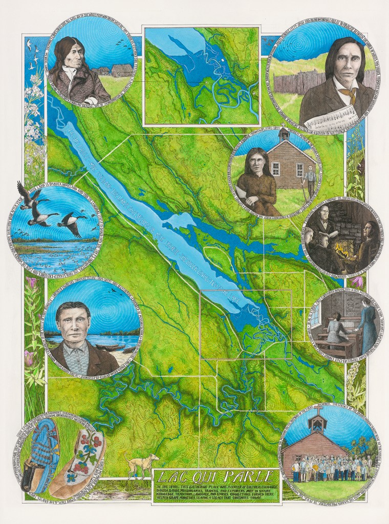
Ink on Paper – 18 x 24 inches – 2026
This historic art map is focused on lower Lac qui Parle Lake in the 1840s, where a large Dakotah village was located across the Minnesota River from a trading post named Fort Renville. Here, Joseph Renville started a fur trade operation while Dr. Thomas Williamson led the development of the Lac qui Parle Mission. Renville and Williamson then led the development of the Dakota alphabet and the introduction of Christianity. This map captures a time period filled with stories of survival, assimilation, and friendships between people of different heritages and cultures.